|
|
UMBC |
This
project has been designed and produced by the Advanced Cartographic Design
class of 2006 at the University of Maryland Baltimore County campus under the
direction of Thomas D. Rabenhorst. It
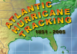
is a major expansion of an earlier, less exhaustive hurricane-plotting project
by the Advanced Cartographic Design class of 2000*. Hurricane tracks now
include all years from 1851 to 2005. Additionally, new Landfall maps, Hurricane
Intensity maps, and Decade pages have been produced. Without the dedication and
cartographic skill of these diligent students this project would not have been
possible. The following students should be commended for their outstanding contribution
to this project: Jordan Bosley, Shawn Griffin, Christopher
Mizurak, Melanie Rogers, Brendan Bartow
*(T. Corder, C. Ence, R. Gelner, J. Hillman, K.
Hoffman, J. Lukens, R. Maloy, A. Neilson, D. Nickless, A. Novak, R. Ories, J. Ryan,
R. Workman, D. Zavorka).